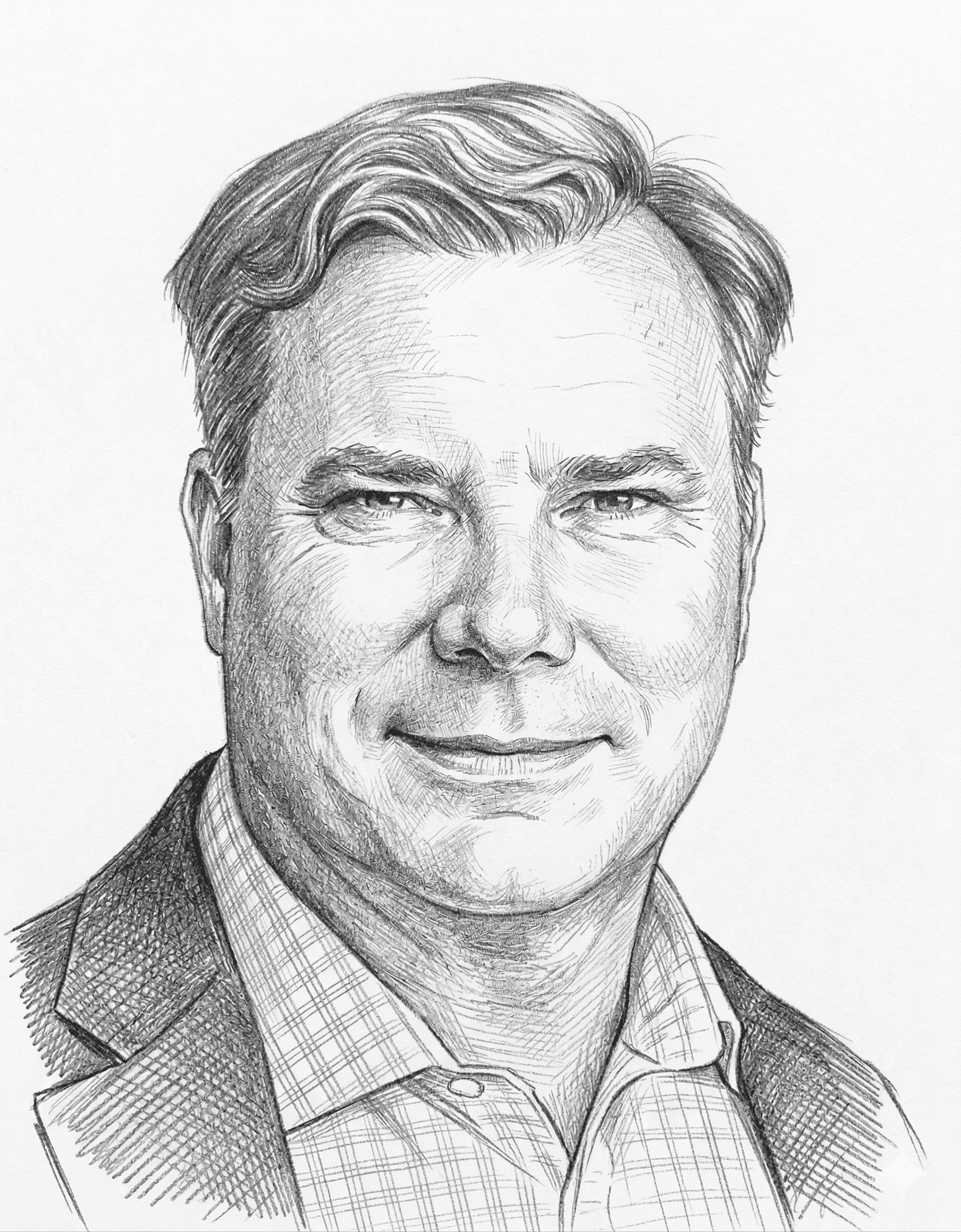

Q&A with Walter Scott, Founder of DigitalGlobe
One of the major commercial satellite companies is DigitalGlobe. The Cipher Brief sat down with its founder, Walter S. Scott, who discussed the universal availability of imagery today and the dramatic changes impacting both the industry and the U.S. government.
The Cipher Brief: You helped, in many ways, to create the commercial satellite industry as we know it. How did you get involved in that area, and what was the genesis for your interest in satellites?
Dr. Walter S. Scott: As a child of the Space Age, the genesis of my interest in satellites was the whole space program back in the 1960s, which was happening while I was a kid. But as far as starting DigitalGlobe is concerned, I was a program manager at the Lawrence Livermore National Laboratory working on the Brilliant Pebbles program, part of the Strategic Defense Initiative. The Cold War ended, and I started looking around for what to do next, and that’s what ended up leading to my founding of DigitalGlobe - at the time, called WorldView Imaging Corporation - in January of 1992.
TCB: Since then, the industry has changed dramatically. In your view, what have been some of the most significant changes and where do you see the industry heading?
WS: I would probably characterize three significant changes. First, satellite imagery is available to basically everybody now. When Google Maps first launched a decade ago, that was exposing something that previously was only seen by a small number of organizations. Now billions of people around the world use satellite imagery as part of their daily lives.
The second big change, which was actually quite surprising to me at the time, was the degree to which commercial satellite imagery has taken on an increasingly larger role in serving the U.S. government. And that has been, in large part, because it is unclassified, it is sharable, and it is able to support the needs of the U.S. government and our allies in a world where things are happening everywhere. It’s no longer the world we had to worry about during the Cold War, where we just really needed to pay attention to a handful of countries.
The third trend is the advent of the compute cloud, which makes it possible for, not just the viewing of data, but computation of the data in a way that doesn’t require the end user to own or operate the sort of vast computer infrastructure that previously was required.
TCB: Broadly speaking, where do you see the industry heading and what are some changes that you are anticipating in the future?
WS: Well, one of them certainly builds on the cloud point. If you no longer need to create a big infrastructure for working with large amounts of imagery – what we call Geospatial Big Data – then suddenly the barrier to use has gone way down. That, combined with the growing availability of algorithms for extracting information from imagery, means there has been a major change from simply viewing a picture to actually converting that picture into useful information. That’s a change that is pretty recent.
I think another area in which the industry is changing is that we’re seeing some novel applications from satellite players who are new to the industry. It’s not really directly competitive with the sort of thing that DigitalGlobe has been doing, but they may represent opportunities for new use cases. In that regard, they are expanding the set of uses for satellite imagery.
TCB: What would you say are some of the biggest challenges your company faces as an industry leader in the near term?
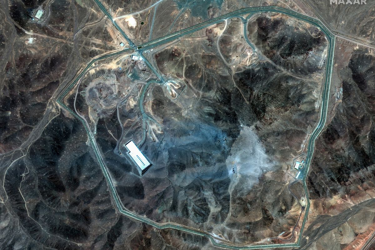
WS: I think that probably the biggest challenge that you face as an industry leader is people always asking, “What are you going to do next?” That question builds on my point about the cloud. We’re sitting on about 70 petabytes worth of imagery. We’ve covered the land surface area of the planet more than 40 times over, and we’ve exposed imagery in the cloud in a way that nobody else comes even remotely close to. Our Image Library goes back to 1999, and this volume of commercial satellite data is unrivaled in its resolution, accuracy, spectral content, and temporal depth. That’s really a big opportunity.
TCB: Turning to your relationship with the federal government, what are some of the biggest changes you’ve seen in that relationship, and how has the demand for geospatial intelligence changed over the past 10 years?
WS: Initially, we had not anticipated that there would be much demand by the U.S. government. But as we’ve seen over the last decade, it has gone from requiring sample data to a situation where we are supporting the vast majority of the mapping requirements for the U.S. government. We are providing shareable, commercial imagery, disseminated over the web to users. It’s imagery that is current, meaning that it’s available on the web portal within a few hours, sometimes as fast as 12 minutes after it’s downlinked from the satellite. It’s a world that’s working at Internet speed and dealing with Internet volumes. Now, we’re very mainstream.
TCB: Would you say that the shift in the demand is the single greatest change in the relationship between your industry and the federal government?
WS: The increase in demand is obviously important, and that increase in demand has brought with it a much greater degree of customer intimacy, engagement, and understanding. There’s a lot of track that we’ve laid between DigitalGlobe and the U.S. government that makes for a very close working relationship.
TCB: The satellite industry is a great example of the Public-Private Partnership model. What do you think both industry and the government can do better to strengthen that partnership?
WS: Industry is a source of continuous innovation that governments can leverage to support many types of mission needs. You touched on a couple examples like the search for MH370, in which we engaged a crowd around the world of about 8 million people searching through 1 million square kilometers of ocean looking for indications of debris from the wreckage of an airplane. That led to work we did supporting the relief efforts after the Nepal earthquake and work that we’ve done in support of the response to the Ebola outbreak in Africa. It’s more than just imagery. It’s converting the imagery into useful information that can be used to derive results, or what the director of NGA would refer to as “consequence,” that is ultimately beneficial to both the nation and the people that we’re helping.
TCB: Your NGA contract, the Global Enhanced GEOINT Delivery (Global EGD) Program, will be renewed. Why that is important?
WS: That’s the program that I was really referring to, with the web delivery that gets imagery in the hands of users around the world minutes or hours after it has been collected. It’s a way of getting that imagery in the hands of people who need to use it. Not just imagery, by the way, but also analytic tools. Whether a user needs to find a helicopter landing zone, or know what they can see and what can see them from a particular point, or understand how well their radio signals will propagate in a particular area, all of those are particularly important for both mission planning and disaster response.
The world today is not the world of even ten years ago where everything happened on a desktop. The world today is one where a lot happens on mobile devices and a lot of the heavy lifting and heavy computing is happening in the cloud. Global EGD is a great example of that, where we end up serving our U.S. government customers at Internet speed with the kind of tools that we all expect to live with in our daily lives. Global EGD brings that to the government user base.
TCB: Based on your career in this industry, are you surprised at where things are right now and how rapidly things have changed?
WS: I would say that is has been 100 times harder than I had hoped and infinitely easier than I had feared. By that I mean, nothing ever happens on its own. There have been a lot of people who have contributed to the success of this industry and have overcome a large number of challenges. I am extremely pleased with just how big this industry has become and how relevant it is to so many people around the world.