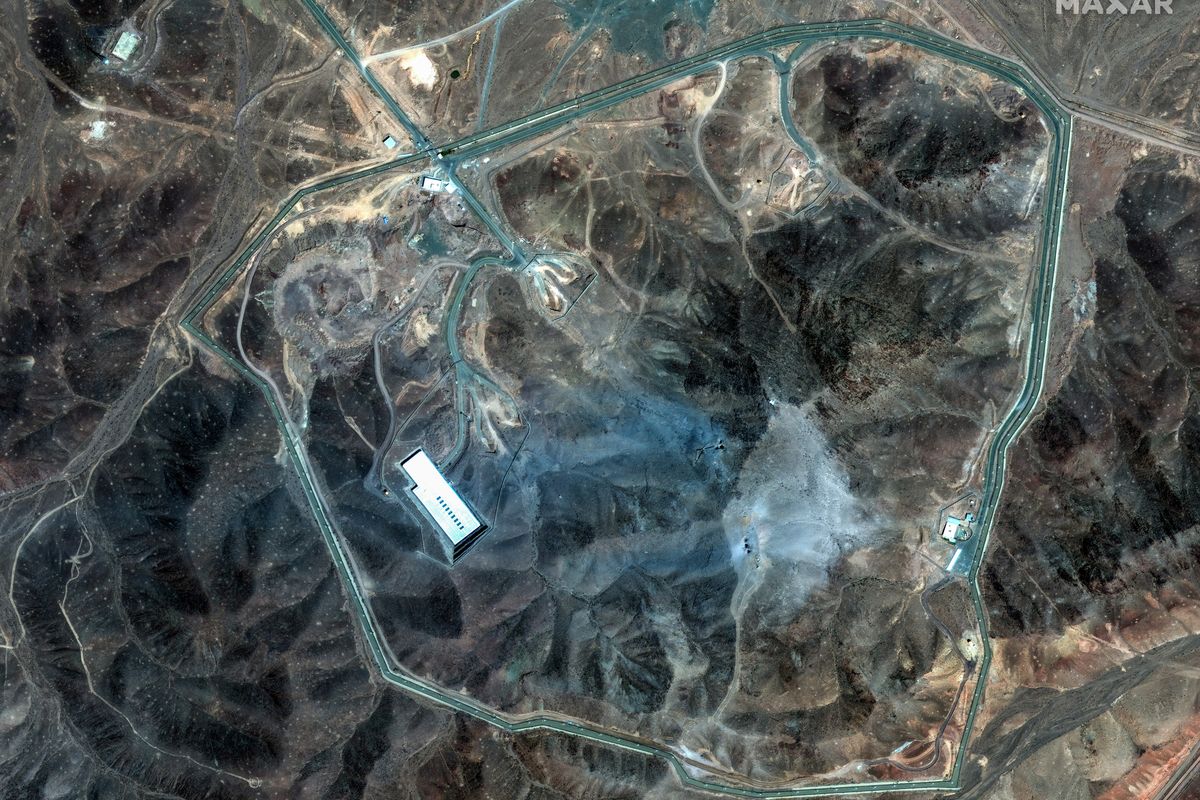
You may not realize it, but every day you interact with geospatial intelligence (GEOINT). Whether it’s the think tank that’s monitoring the Syrian refugee migrations, the academic institutions that are tracking Arctic ice extents, or the small satellite revolution, today’s innovative technology and crowded skies present a unique moment for the geospatial intelligence community, and this infliction point demands action.
Our job at the National Geospatial-Intelligence Agency (NGA) is to provide intelligence derived from the exploitation of imagery and geospatial information to assess geographically-referenced activities on Earth. As our adversaries get smarter about GEOINT, and satellite technology and imagery becomes widely available, the future requires us to reshape GEOINT to break down barriers to intelligence integration.
The future begins with us. And NGA has responded to this new environment by expanding our partnerships, both traditional and emerging, as well as investing in new technologies for our analytical processes. We’ve also encouraged our partners and our workforce to think beyond traditional sources to bring the best that GEOINT has to offer in achieving our mission.
I joined the intelligence community in the 80’s. In those days, we had a monopoly on almost all aspects of our discipline. We had phenomenal GEOINT data sources, like satellite imagery, that only the richest and most advanced countries could afford. And it wasn’t just imagery. We had exclusive access to the analysts, the analytic tools, and an almost proprietary knowledge of how to exploit the data for our closely-guarded intelligence products.
But time marches on. And, like most monopolies, ours broke up, thanks to an explosion of satellite launches by other governments and business both large and small. Commercial and open source satellite imagery have burst onto the scene and have begun leveling the playing field between government agencies and small tech startups. Think tanks and NGOs have their own analysts and tools and report daily to the general public on humanitarian crises using changes they’ve observed via commercial imagery sources.
In this new GEOINT world, private and nonprofit organizations don’t just collect imagery. They also perform tasks that used to be part of the government monopoly – establishing collection strategies to optimize precious resources, developing the computing power to receive formed images on their workstations, and employing tradecraft and signatures that they exploit in order to make assessments. They also have the power and reach of the Internet to rapidly and persuasively disseminate images and assessments.
Today, everyone’s in the game.
With change comes opportunity. Thus we need to shift to a model that takes advantage of this stunning array of moving parts and pieces to conduct predictive analysis. If we can identify and leverage emerging open GEOINT sources, new collection strategies, and developing computing algorithms, we will disadvantage our adversaries and enhance our country’s position in the world. We can also use this information to aid in humanitarian and environmental efforts. The opportunities for GEOINT are limitless.
One of our long-time, integral partners in developing automated intelligence analysis from our space imagery is the National Reconnaissance Office (NRO). The Sentient program is a research and development effort, conducted jointly with NRO, to experiment with automation that ingests data, makes sense of it in the context of an intelligence problem, and then infers likely future intelligence and collection needs.
To do this, Sentient is recasting the linear Tasking-Collection-Processing-Exploitation-Dissemination cycle, or TCPED, to decrease the time required to understand the information that is collected and task future collections to confirm or deny a problem-focused hypothesis. The approach is to continue to introduce automation in the processing arena that will support automated inferencing, and therefore, faster tasking for future collections.
We’re also assessing and engaging new space companies. For example, NGA is under contract with Planet, which has almost 150 four-kilogram satellites in orbit that will, in the next few months, begin delivering a “skin” of the earth every day. We’re learning a lot about their three- to five-meter resolution imagery, and how consistent collection at a global scale can be used for our customers’ operational use cases.
We’ve even launched an experiment called “GEOINT Pathfinder” to help navigate the world of commercialized GEOINT. The Pathfinder project uses only unclassified tools, IT, and services in the commercial and open world to create a sense of urgency around finding new methods and operating models. The results, so far, have exceeded our high expectations. Among other things, we created unique value through Volunteer Geographic Information, social media, commercial subscriptions, and open data. And we’ve avoided proprietary and commercial licensing costs by using open source software.
We’re continually taking steps to make it easier for small companies – and even individuals, as well as large traditional defense contractors – to engage and partner with us. That’s why we created the Commercial Initiative to Buy Operationally Responsive GEOINT, or CIBORG. Leveraging the General Services Administration (GSA), it’s a single point of contact, allowing NGA to access and purchase commercially-provided imagery, data, analytical capabilities and services.
Additionally, we’ve stood up the Commercial GEOINT Activity, or CGA, which will be NGA’s and NRO’s primary mechanism to engage commercial partners to satisfy current and future GEOINT needs across the U.S. government. CGA will allow NGA and NRO to assess commercial GEOINT capabilities and make recommendations for strategic and tactical investments. CGA will also support the development of policy proposals to better embrace commercial GEOINT while balancing U.S. national security concerns.
The crowded skies create a unique opportunity for the GEOINT community. The ever-increasing number of satellites gives us unprecedented access to data, an unparalleled spatial-temporal awareness, and an improved ability to apply that awareness to both national security and nonsecurity-related activities. But to take advantage of the new GEOINT environment, we in government need to work closely with the private and non-profit sectors to enhance and customize their cutting edge artificial intelligence and automated analysis tools – freeing up our human analysts to focus on the issues, problems, and questions that automation can’t answer. This will allow us to better anticipate events. And there are plenty of other benefits to our partnership, including the sharing of information, knowledge, skills, and data that could lead to the development of NASA-like technological innovations that can benefit everyone, and an enhanced ability to leverage GEOINT data to respond to humanitarian crises.
When I think back on my early days in this business, I’m tempted to believe that I was part of the “Golden Age of GEOINT,” when government data was King. But that’s wrong. The “Golden Age” is a large tangled mass of geospatial data from a mix of public and private sources that – analyzed quickly, accurately, and in partnership with international experts – yields almost a minute-by-minute comprehensive picture of our large complex world. The Golden Age of GEOINT most certainly is now.


